
Reviste
-
Acta Horti Botanici Bucurestiensis
Acta Horti Botanici Bucurestiensis este o revistă știintifică internatională înființată în 1959, publică o dată pe an. Jurnalul publică lucrări originale axate pe aspecte ale anatomiei și morfologiei plantelor, botanică sistematică, biodiversitatea plantelor, algelor și ciupercilor, fiziologiei și biochimiei plantelor, geneticii și biotehnologiei plantelor, patologia plantelor, horticultură.
-
Analele Universității București.Geografie
Analele Universitatii Bucuresti: Geografie (Annals of the University of Bucharest – Geography Series) is a yearly peer-reviewed scientific journal dating since 1952. It has an integrative approach publishing articles from various fields of interest both of physical geography (geomorphology, climatology, hydrology, etc.) and of human geography (geodemography, settlement geography, social geography, etc.). Its aims are to comprise themes of large interest from various domains of activity for geographers in general as geography itself is a broad discipline with a high interdisciplinary character. The journal contents research articles, discussions of current issues of large interest for different geographic disciplines, case studies, reports, book reviews. Articles are relevant to both academics and practitioners, and are the results of anonymous reviews by at least two referees chosen by the editor for their specialist knowledge.
-
Analele Universității București. Informatică
Revista este dedicată în primul rând lucrărilor în domeniul informaticii. De asemenea, publica o listă de probleme deschise, recenzii de cărți, monografii, lucrări și diverse. De mare interes sunt următoarele domenii: Inteligența artificială, Teoria automatelor, Complexitatea computațională, Simularea computerizată și Metodele Monte Carlo, Limbaje formale, Scheme de programe, Teoria limbajelor de programare, Funcții recursive. Sunt incluse și alte subiecte, cum ar fi Algebra Booleană, Combinatorică, Matematică constructivă, Teoria graficelor, Statistica computațională și Analiza numerică, în măsura în care sunt relevante pentru Informatică.
-
Analele Universitatii din Bucuresti – Seria Istorie
Analele Universităţii din Bucureşti – Istorie este un periodic bazat pe procesul de peer review și este una dintre cele mai vechi periodice universitare cu tematică istorică. A început să apară din anul 1956, iar din 2011 frecvența de apariție a crescut la două fascicule pe an.
Analele Universităţii din Bucureşti – Istorie a promovat încă de la începuturi cercetări originale. În timp, i-a publicat pe unii dintre cei mai importanți istorici români ai vremii și un număr important de cercetători din străinătate. Revista publică pe teme referitoare la toate perioadele istorice și la toate domeniile cercetării istorice. De asemenea, găzduiește materiale cu caracter teoretic și metodologic legate de cercetarea, interpretarea și scrierea istoriei.
Analele Universităţii din Bucureşti – Istorie publică articole originale, curpinzând cercetări și interpretări relevante, recenzii, cronici științifice. În ultimii ani, revista i-a încurajat pe masteranzi, doctoranzi și tinerii cercetători să trimită aplicații de bună calitate în vederea publicării.
-
Analele Universității București.Filosofie
The Annals of the University of Bucharest – Philosophy series, is a philosophical research open-access journal, published by the University of Bucharest, Faculty of Philosophy.
The Annals of the University of Bucharest, Philosophical series, is a scholarly double blind peer reviewed journal. The journal publishes articles considered of relevance for those interested in the field of philosophy and is addressed both to the Romanian and international philosophical community, with a special accent on East- and Central-European area.
The Annals of the University of Bucharest, Philosophical series, is devoted to the exploration of different topics of Philosophy.
Currently the journal is indexed by EBSCOhost, Philosopher’s Index with Full Text , ERIH PLUS, CEEOL, DOAJ, ESCI. -
Analele Universității București. Limba și literatură română
Cu o lungă tradiţie, revista Analele Universităţii Bucureşti. Limba şi literatura română publică articole şi recenzii care tratează teme de interes filologic din diverse domenii conexe: lingvistică privind româna și/sau alte limbi; literatură română; literatură universală şi comparată; teoria literaturii; folclor românesc şi comparat; antropologie culturală. Sunt încurajate, deopotrivă, cercetările din perspectivă pluri- și interdisciplinară, care plasează limba, literatura și cultura română într-un cadru de analiză extins, în acord cu dinamica cercetării științifice actuale din plan internațional.
Revista apare anual, în ediție tipărită și în variantă electronică; revista este disponibilă integral în format online, pe pagina web: http://anale.litere.ro/index.html, fără taxe de utilizare.
Revista este indexată în baze de date internaționale (Erih Plus, Ebsco, CEEOL etc.) și acreditată CNCS (categoria B).
-
Analele Universităţii Bucureşti. Limbi şi Literaturi Străine
Analele Universităţii Bucureşti. Limbi şi Literaturi Străine este o publicaţie ştiinţifică bianuală care acoperă diverse domenii filologice de interes: lingvistică, literatură, studii culturale, traductologie.
Anul de apariţie: 1952.
-
Analele Universității din București. Științe Politice
Analele Universităţii din Bucureşti. Seria Ştiinţe Politice este revista Facultăţii de Ştiinţe Politice a Universităţii din Bucureşti şi este publicată în sistem peer-review (double-blind). Înfiinţată în 1999 ca anuar, din anul 2011 apare de două ori pe an şi reuneşte cercetări din toate ariile ştiinţelor politice, promovând astfel o perspectivă interdisciplinară asupra disciplinei. Revista publică articole în mai multe limbi (engleză, franceză sau română) din toate ariile disciplinare legate de domeniul științelor politice: teorie politică, sociologie politică, relații internaționale, istorie politică, drept și economie politică. Revista îşi propune să stimuleze crearea unor noi spații de interacţiune în cercetarea de înalt nivel şi să faciliteze contactul dintre diferitele medii academice româneşti şi internaţionale. În fiecare număr sunt publicate studii ale unor autori consacraţi, dar sunt încurajate şi contribuţiile venite din partea tinerilor cercetători, inclusiv sub forma unor note de lectură şi recenzii.
Analele Universităţii din Bucureşti. Seria Ştiinţe Politice este o revistă disponibilă în sistem de acces liber. Revista nu percepe taxe pentru procesare ori publicare, iar referenții verifică pro bono calitatea științifică a manuscriselor primite de redacție.
În versiunea tipărită este arhivată de Biblioteca Națională a României (depozit legal) și este disponibilă în sistemul Bibliotecii Centrale Universitare care poate trimite copii prin împrumut inter-bibliotecar național sau internaționale. Arhiva digitală este disponibilă integral pe site-ul revistei, precum și în mai multe baze de date internaționale.
-
Bucharest Working Papers in Linguistics
Bucharest Working Papers in Linguistics (BWPL) publică lucrări originale din toate domeniile lingvisticii teoretice și aplicate: sintaxă, fonetică, fonologie, morfologie, semantică, pragmatică, achiziția și învățarea limbii, lingvistică computațională, pidginuri și creole, traductologie și lingvistică clinică. Revista reprezintă o platformă pentru cercetarea sincronică și diacronică a limbilor, fără să privilegieze vreo abordare teoretică anume.
BWPL publică articole, articole monografice și recenzii ale unor publicații recente de specialitate. De asemenea, acceptă propuneri de numere tematice.
Revista are două numere pe an. Apare pe suport de hârtie și online.
-
Bukarester Beiträge zur Germanistik
BBG îşi propune să ofere o platformă de discuţii pentru teme lingvistice, literare, translatologice şi didactice din spaţiul de limbă germană. Ediţiile tematice anuale ale revistei pot cuprinde şi articole necircumscrise temei respective într-un capitol varia.
-
Euro-Atlantic Studies New Series
Revista Euro-Atlantic Studies este o revistă academică publicată de Centrul de Studii Euro-Atlantice „Prof.univ.dr. Constantin Bușe” al Universității din București. Fondată în 1998, revista își propune să pună la dispoziția comunității științifice, dar și a publicului larg, rezultatele unor cercetări recente vizând istoria relațiilor internaționale
-

GeoPatterns
GeoPatterns a fost înființată în 2016, fiind o revistă susținută și promovată de Centrul pentru Studii de Risc, Modelare Spațială, Dinamica Sistemelor Terrestre și Costiere, Departamentul de Geomorfologie, Facultatea de Geografie, Universitatea din București. GeoPatterns publică lucrări de cercetare originale, de înaltă calitate științifică, cu DOI atribuit, în toate domeniile geosciințelor și științelor umaniste care aplică metodologii spațiale, precum și recenzii, note de cercetare și rapoarte. Scopul GeoPatterns este de a construi un cadru pentru înțelegerea holistică a planetei Pământ și a mediilor sale naturale și sociale, prin identificarea acelor paternuri complexe care susțin existența.
Toate lucrările științifice acceptate pentru publicare sunt analizate și evaluate de un comitet științific format din profesori universitari și cercetători din țară și străinătate, recunoscuți la nivel internațional în domeniul lor de expertiză.
Acoperirea tematică a revistei GeoPatterns face ca această revistă să fie o lectură de interes pentru geografi, dar și pentru cercetători din alte discipline, precum managementul dezastrelor, ecologie, geologie, sociologie, psihologie, antropologie, mediu, planificare urbană și studii culturale. Limba principală a revistei este engleza.
GeoPatterns este o revistă cu acces liber, iar conținutul revistei este disponibil gratuit imediat după publicare.
-
Human Geographies – Journal of Studies and Research in Human Geography
Human Geographies – Journal of Studies and Research in Human Geography a fost publicat pentru prima dată în 2007 pentru a oferi un forum internațional de contribuții sociale, economice și culturale în domeniile geografiei umane. Este un jurnal peer-reviewed, are atât versiuni online, cât și versiuni tipărite și ISSN. Reprezintă inițiativa și efortul membrilor Departamentului de Geografie Umană, Facultatea de Geografie din cadrul Universității din București.
Human Geographies – este o publicație semestrială cu un conținut exclusiv în limba engleză care poate fi vizualizată pe humangeographies.org.ro.
Human Geographies se angajează să publice cercetări academice și comentarii informate cu privire la o categorie largă de aspecte ale geografiei umane (inclusiv probleme urbane și rurale, demografie, mediu social, economic și cultural), probleme legate de locuri și probleme de spațiu. Acesta include contribuțiile unui număr tot mai mare de cercetători și practicieni din geografie, științe umaniste și științe sociale și de mediu, care sunt interesați de geografiile umane, economice și culturale.
Conținutul include articole originale, note și comentarii. Se publicate contribuții originale din domeniile: geografie umană, economie și geografie economică, planificare, dezvoltare teritorială, dezvoltarea infrastructurii, sociologie, studii de populație și administrație publică, politici publice.
-

[Inter]sections
[Inter]sections este o revistă anuală din domeniul studiilor americane, publicată de Programul de Studii Americane, Facultatea de Limbi și Literaturi Străine, în regim online, open access și double-blind peer reviewed.
-
Journal of Comparative Research in Anthropology and Sociology
Journal of Comparative Research in Anthropology and Sociology – Compaso este o revistă academică online, cu acces deschis și un sistem de evaluare anonimă colegială, publicată de Departamentul de Sociologie și Școala Doctorală de Sociologie din cadrul Universității din București. Revista oferă o platformă pentru dialog științific, promovând o perspectivă comparativă care pune în relație cercetarea empirică și reflecția teoretică în domeniile antropologiei și sociologiei, dar și la intersecția acestora.
Compaso își propune să promoveze cercetarea critică axată pe surprinderea proceselor de construcție socială a realităților și formelor de cunoaștere. Orientarea sa comparativă se află în centrul acestei misiuni, invitând contribuții care analizează similitudinile și diferențele atât dintre fenomene apărute în contexte culturale, sociale, istorice diferite, cât și dintre cadre epistemice utilizate în investigarea lumilor. Revista încurajează abordările comparative care investighează și pun în relație cadre teoretice și metodologice diverse, studii de caz divergente sau configurații sociale distincte. Orientarea comparativă a revistei nu se limitează la analiza unor situații din medii geografice sau culturale diferite, ci include și confruntarea paradigmelor teoretice, a strategiilor metodologice și a perspectivelor disciplinare. Compaso primește cu interes contribuții care investighează modul în care procese sociale similare se manifestă diferit în contexte diferite și discută despre cum aceste variații pot contribui la formularea unor teorii mai generale. Sunt valorizate, de asemenea, studiile care compară tipuri diferite de date (de exemplu, etnografice, statistice, de arhivă), tradiții epistemice sau cadre instituționale, în vederea punerii sub semnul întrebării a modurilor de producere și circulație a cunoașterii despre viața socială. Prin aceste demersuri, revista își propune să evidențieze condiționalitățile, interdependențele și multiplicările care modelează atât fenomenele studiate, cât și instrumentele conceptuale prin care acestea sunt înțelese.
Sunt publicate articole de cercetare originale, bazate pe analize empirice riguroase – de natură calitativă, cantitativă sau mixtă – cu o fundamentare teoretică argumentată clar și cu o dimensiune comparativă explicită. Pe lângă articolele de cercetare, Compaso acceptă note de cercetare mai scurte care semnalează rezultate emergente sau reflecții metodologice, eseuri de sinteză care discută critic literatura recentă din domeniu, intervenții teoretice bazate pe o abordare comparativă și recenzii de carte relevante pentru tematica și domeniul revistei.
Anumite numere ale publicației sunt organizate în jurul unei colecții tematice, anunțate printr-un apel public de articole. Cu toate acestea, revista acceptă și contribuții în afara temei anunțate, atâta vreme cât acestea sprijină misiunea sa de promovare a analizei sociale comparative. Prioritate au manuscrisele care depășesc nivelul unei simple comparații descriptive și care utilizează strategii comparative pentru a genera perspective explicative, a contesta categorii conceptuale consacrate sau a propune instrumente metodologice noi.
Revista încurajează în mod activ contribuțiile cercetătorilor aflați la început de carieră, în special ale doctoranzilor și postdoctoranzilor din domeniile antropologiei, sociologiei și ale altor discipline conexe. Manuscrisele sunt evaluate printr-un proces de evaluare colegială dublu anonimizată, pentru a garanta rigoarea științifică și pentru a oferi autorilor un feedback constructiv.
-
MELISENDRA. Journal of Spanish Early Modernity Studies
MELISENDRA. Journal of Spanish Early Modernity Studies publică anual articole de specialitate redactate în limbile spaniolă și engleză, pe teme legate de Modernitatea Timpurie Hispanică. Au prioritate articolele interdisciplinare, elaborate dintr-o perspectivă istorică și comparativă. Conținutul revistei poate fi accesat gratuit pe pagina web a Editurii Universității București/Bucharest University Press și pe site-ul revistei Melisendra.
Fiecare articol inclus în revistă include atât titlul, rezumatul și aproximativ 5 cuvinte cheie, scrise atât în limba engleză cât și în limba spaniolă, cât și numele complet și adresa de e-mail a autorului. Înaintea publicării, fiecare articol a fost supus unui proces de evaluare dublă anonimă, realizată de evaluatori obiectivi și independenți, afiliați la instituții complet diferite de cele ale autorului articolului.
Responsabilitatea pentru ideile și opiniile incluse în articolele publicate în revistă aparține exclusiv autorilor articolelor. Comitetul editorial al revistei MELISENDRA. Journal of Spanish Early Modernity Studies nu poate fi sub nici o formă tras la răspundere pentru veridicitatea sau credibilitatea articolelor publicate. Viziunea, perspectiva și părerile exprimate în articole nu le reflectă obligatoriu și pe cele ale membrilor comitetului editorial. Conținutul articolelor originale publicate în revistă reprezintă proprietatea exclusivă a Editurii Universității din București. Prin urmare, orice citare sau reproducere parțială sau integrală trebuie să menționeze sursa inițială a drepturilor de autor.
-
Revista Cercurilor studenţeşti ale Departamentului de Limba şi Literatura Franceză
Găzduită de Editura Universităţii din Bucureşti – Bucharest University Press, Revista Cercurilor studenţeşti ale Departamentului de Limba şi Literatura Franceză (RCSDLLF) este o publicaţie anuală a Departamentului de Limba şi Literatura Franceză, Facultatea de Limbi şi Literaturi Străine, Universitatea din Bucureşti, înfiinţată în 2012 şi rezervată studenţilor celor 3 cicluri de studiu (licenţă, masterat, doctorat). Revista reuneşte cele mai bune articole rezultate din intervenţiile studenţilor în cadrul celor 5 cercuri ştiinţifice studenţeşti ale Departamentului: Literatură, cultură şi civilizaţie franceză, Lingvistică franceză teoretică şi aplicată, CONTRASTER – Contrastivitate, traducere specializată, terminologie, CENTRAL – Traduceri literare, respectiv Literatura extremului contemporan: Premiul Goncourt. Alegerea studenţilor români (cerc organizat în jurul activităţilor Juriului bucureştean pentru desemnarea laureatului Premiului Goncourt, eveniment cultural internaţional la care Departamentul de Limba şi Literatura Franceză participă din 2013). De asemenea, sunt incluse şi alte tipuri de contribuţii prezentate la diverse manifestări ştiinţifice, naţionale şi internaţionale. Fiecare contribuţie este validată de un specialist, care asumă oficial coordonarea lucrării, precum şi de un prestigios comitet ştiinţific internaţional.
RCSDLLF, o premieră pe plan internaţional ca tip de demers ştiinţific, a instituit un standard de excelenţă pentru cercetarea studenţească, recunoscut ca atare nu doar la nivel naţional, ci şi internaţional, căpătând din 2013 o mare vizibilitate odată cu participarea Departamentului de Limba şi Literatura Franceză, prin echipe studenţeşti de elită, la jurizarea anuală pentru acordarea Premiului Goncourt. Din 2017, Revista găzduieşte şi contribuţii ştiinţifice primite din partea altor Departamente de Franceză din România.
RCSDLLF se individualizează în peisajul publicaţiilor ştiinţifice de înaltă clasă printr-o dublă delimitare: tinereţea autorilor, care, deşi nu sunt încă cercetători consacraţi (cei mai mulţi fiind proaspeţi absolvenţi ai ciclului licenţă – lucru cu totul special în peisajul publicaţiilor internaţionale de gen), fac dovada unei remarcabile maturităţi analitice şi hermeneutice, dar şi specificul publicului căruia i se adresează (studenţi, masteranzi, doctoranzi), pentru care RCSDLLF, prin profilul ei, funcţionează ca un etalon al cercetării de top.
Toate contribuţiile ştiinţifice publicate în RCSDLLF sunt redactate în limba franceză.
-
Revista CICSA online, serie nouă/ CICSA Journal online, New Series
CICSA Journal, New Series is an annual online peer reviewed publication of the Center for Comparative History of Ancient Societies (CICSA) which includes studies, articles (written in French, English, German, Italian or Spanish), book reviews and book presentations in History, Ancient History, Archaeology, Art, Cultural History, Cultural Studies.
The published material represents mainly the research conducted at the Center, the presentations in its monthly and annual sessions, but also other multidisciplinary approaches on topics related to the mentioned above areas of research. -
Romanian Journal of Journalism and Communication
Field: A peer-reviewed academic journal dedicated to research in journalism, communication studies, and media theory, with a critical, interdisciplinary approach.
Publisher / Institution: Published by the Faculty of Journalism and Communication Studies, University of Bucharest.
Languages: The primary language of publication is English, with an option to accept submissions in French.
Aim and Scope: The journal aims to connect Romanian and Central and Eastern European scholarship to the global field of communication studies, while also bringing relevant international research into dialogue with the region. It promotes original, critical contributions that explore transformations in media, journalism, technology, and the public sphere from comparative, interdisciplinary, and global perspectives.
Types of contributions: Publishes theoretical, empirical, and critical articles, case studies, as well as book reviews. Innovative and emerging approaches in communication research are encouraged. -
Reviews in Biological and Biomedical Science
Reviews in Biological and Biomedical Sciences (Rev. Biol. Biomed. Sci.) is a new online only, open access, multidisciplinary journal, launched by Bucharest University in 2018.
Welcoming outstanding review articles of any length from around the world, Rev. Biol. Biomed. Sci. will cover all disciplines in biological and biomedical sciences such as biochemistry, biodiversity, bioinformatics, biomedical engineering, biophysics, biotechnology, cell biology, clinical chemistry, cytopathology, developmental biology, ecology, epidemiology, ethology, genetics, hematology, histopathology, immunology, microbiology, molecular biology, morphology, mycology, oncology, parasitology, pharmacology, physiology, reproductive technology, stem cells, systematics, tissue banking/transplant, toxicology.
The journal encourages submissions from current or recently completed PhD students, and young researches, but we welcome the submissions from established experts regardless of their age.
Manuscripts that pass the initial assessment are peer-reviewed to a high standard and final decisions are based on the reports received from the referees.
The Journal of biological and biomedical sciences reviews is free to access online and there are no manuscript submission charges nor article processing charges and no publication fees. All Rev. Biol. Biomed. Sci. papers are free to read, share and reuse for non-commercial purposes under the CC-BY-NC 4.0 licence.
Journal of biological and biomedical sciences reviews allow the author(s) to hold the copyright and to retain publishing rights without restrictions.
Website: https://rev-biomed.unibuc.ro/
-
Romano-arabica
Romano-Arabica apare neîntrerupt din anul 2001 ca publicație cu peer-review a Centrului de Studii Arabe al Universității din București. În anul 2018, revista a fost evaluată de ANVUR (Agenzia Nazionale di Valutazione del Sistema Universitario e della Ricerca) în categoria A-class Academic Journal Articles, iar în anul 2020, a fost evaluată de CNCS (Consiliul Național al Cercetării Științifice) ca revistă de categoria A în domeniul științelor umaniste. Activitatea revistei este dedicată studiului limbii arabe (clasice și dialectale), literaturii arabe (clasice și moderne), găndirii islamice, societăților islamice, interacțiunii dintre civilizația arabă și alte civilizații etc. Din board-ul editorial și consultativ al revistei fac parte membrii universitari ai Centrului de Studii Arabe al Universității din București, dar și cercetători de top în studii arabe și islamice afiliați unor instituții academice prestigioase din întreaga lume.
Revista este indexată în SCOPUS - https://www.scopus.com/sourceid/21100394703
-
Romanian Biotechnological Letters
Revista Romanian Biotechnological Letters (RBL) a fost fondată de Prof. IOAN I.F. DUMITRU în anul 2001 sub egida Universității din București, cu suportul Ministerului Educației și Cercetării (UEFISCDI).
RBL este o o revistă Open access cu 6 numere pe an, care publică articole originale, recenzii de literatură, comunicări științifice scurte (de max. 3 pagini) în domeniul biotehnologiilor (verzi, rosii, albe, albastre, bioinformatică) și al cercetării interdisciplinare în medicină, neuroștiințe, agricultură, zootehnie, ecologie și protecția mediului.
-
Revista Română de filosofie analitică
The journal publishes articles in analytic philosophy broadly construed. Topics range from logic, philosophy of mathematics and epistemology to metaphysics, philosophy of biology, philosophy of cognitive science and philosophy of language, but is not limited to these areas. Submissions are subject to peer blind review. For issues in the past two years, more than 28% of submissions were published after at most two rounds of review. The journal primarily targets early career researchers in philosophy or doctoral students, but carefully analyzes each submission and is open to all collaborative projects, especially those coming from researchers in social sciences or humanities.
-
Romanian Studies Today
Romanian Studies Today este o revistă transdisciplinară care își propune să mențină constantă preocuparea pentru temele de dezbatere științifică din domeniile filologice și ale studiilor regionale. Revista apare anual, în ediție tipărită și în variantă electronică. Principalele sale axe de interes: poziționarea studiilor românești ca parte integrantă a disciplinelor socio-umaniste contemporane, problematici ale procesului de învățare a limbii române ca limbă străină. Romanian Studies Today se adresează româniștilor din universități și institute de cercetare, dar și specialiștilor în studii regionale, istorie, antropologie, studii politice sau cercetătorilor din alte discipline care sunt interesați de limba și cultura română.
Romanian Studies Today este editată de Centrul de Studii Românești al Facultății de Litere, Universitatea din București. Revista Romanian Studies Today a apărut cu ocazia înființării Centrului de Studii Românești în cadrul Facultății de Litere. Centrul și-a propus editarea unei publicații periodice pluri- și interdisciplinare – după toate rigorile științifice în vigoare –, destinate circulației naționale și internaționale, având în centrul domeniul studiilor românești. Primul număr a apărut în 2017. Deși relativ nouă, revista se bucură de participarea unor nume prestigioase din domeniul studiilor românești din România și de peste hotare.
-
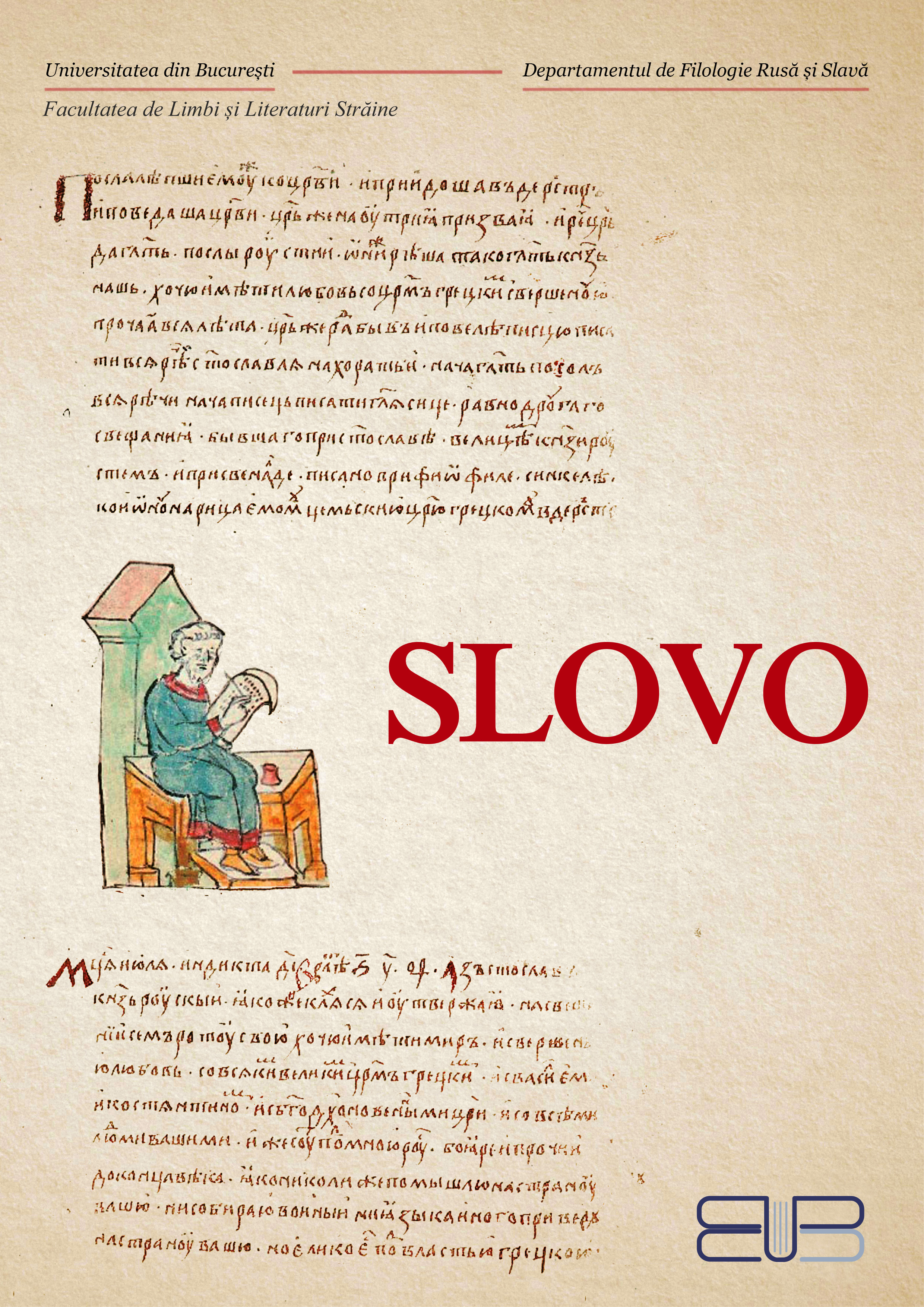
Slovo
Slovo este o revistă academică multidisciplinară, care publică lucrări ale studenților, masteranzilor și doctoranzilor afiliați Departamentului de Filologie Rusă și Slavă, de la Facultatea de Limbi și Literaturi Străine a Universității din București și din alte centre universitare. Domeniile de interes ale publicației sunt literatura și cultura, lingvistica, mentalitățile, precum și aspectele sociale și politice din spațiul slav și est-european. Slovo încurajează cercetarea academică în rândul studenților, oferindu-le o valoroasă ocazie de publicare precoce. Revista validează articolele științifice originale, recenziile de cărți recente și traducerile literare din arealul slav.
-
Studia Doctoralia Psychology and Educational Science
Studia Doctoralia Psychology and Education este revista oficială a Școlii Doctorale de Psihologie și Științele Educației, Universitatea din București, România, publicată de Centrul Doctoral pentru Cercetare Interdisciplinară, Inovație și Dezvoltare Durabilă (CCIIDD). Publicul și potențialii contributori includ cercetători, educatori, consultanți, practicieni, doctoranzi, profesori și alți profesioniști din întreaga lume și din toate domeniile aplicate ale psihologiei și științelor educației.
-
Studia Politica. Romanian Political Science Review
Studia Politica. Romanian Political Science Review publică articole, evaluate de către specialiști, în toate domeniile majore ale științelor politice - politică românească, politică europeană, teorie politică, politică comparată, sociologie politică, politică publică, relații internaționale și studii globale. Fondată în 2001 și concentrându-se în special pe Europa Centrală și de Est, publicația primește contribuții care tratează o gamă largă de zone geografice și teme care au ca scop avansarea domeniului prin studii inovatoare, atât teoretice, cât și empirice. Revista invită autorii să participe cu articole originale, recenzii de cărți și eseuri critice.
-
Styles of Communication
Styles of Communication is an international open access journal which is published bi-annually by the Faculty of Journalism and Communication Studies (University of Bucharest, Romania) in cooperation with the Committee for Philology of the Polish Academy of Sciences, Wrocław Branch, Poland.
The main purpose of Styles of Communication is to show the unity existing within global diversity. As communication implies, besides the transfer of information to others and the decoding of the others’ messages, the production of meaning within (non)verbal texts/objects is closely connected to interculturality, creativity and innovation and it needs a refining of styles in order to avoid misunderstandings.
This journal is a plea for interdisciplinarity as its aim is to include different perspectives on cultural studies, coming from different fields, such as communication, political and sociological studies, public relations, semiotics, linguistics, anthropology, translation studies and so on.
-
Theoretical and Applied Linguistics@ro
Theoretical and Applied Linguistics@ro is an open access journal edited by the Department of Linguistics at the University of Bucharest, Faculty of Letters.
-
University Arena
JURNAL ANUAL DE ARTICOLE IN DOMENII INTERDISCIPLINARE: STIINTA SPORTULUI SI EDUCATIEI FIZICE SI SANATATE
-
University of Bucharest Review. Literary and Cultural Studies Series
University of Bucharest Review. Literary and Cultural Studies Series este o revistă cu structură tematică şi apare sub egida Departamentului de engleză, Universitatea din Bucureşti, avînd o apariţie anuală regulată, începând din anul 1999.
Printre autorii publicaţi s-au numărat, în afară de membri ai Departamentului de Engleză, nume prestigioase din anglistica şi americanistica internaţională (universitari americani, britanici şi din alte ţări europene, asiatici, australieni, africani sau canadieni), iar calitatea articolelor redactate exclusiv în limba engleză a fost asigurată de sistemul de double blind peer-reviewing pe care îl practică editorii revistei.
Cu o abordare interdisciplinară şi tratând problematici importante pentru dialogul cultural de astăzi, University of Bucharest Review. Literary and Cultural Studies Series (UBR) reprezintă o contribuţie semnificativă în spaţiul academic naţional şi internaţional. -

Verbum. Revista de teologie catolică
Verbum. Revistă de Teologie Catolică se înscrie în tradiția editorială inaugurată la București de Revista Catolică, în care au publicat, între 1912 şi 1916, teologi și intelectuali catolici precum Arhiepiscopul Raymund Netzhammer, Fericitul Vladimir Ghika, Carol Auner, Mariu Theodorian-Carada, C.I. Filitti sau Fericitul Anton Durcovici. În 1990, la iniţiativa Arhiepiscopului Ioan Robu, tradiția a fost reluată de Revista Catolică Verbum, ce a apărut până în 1996 și la care au contribuit, printre alții, Ion Gheție, Petre Ș. Năsturel sau Violeta Barbu. Din 2001 și până în 2018, Caietele Institutului Catolic au conferit reflecției teologice catolice o vizibilitate sporită în mediul academic bucureștean.
