
Journals
-
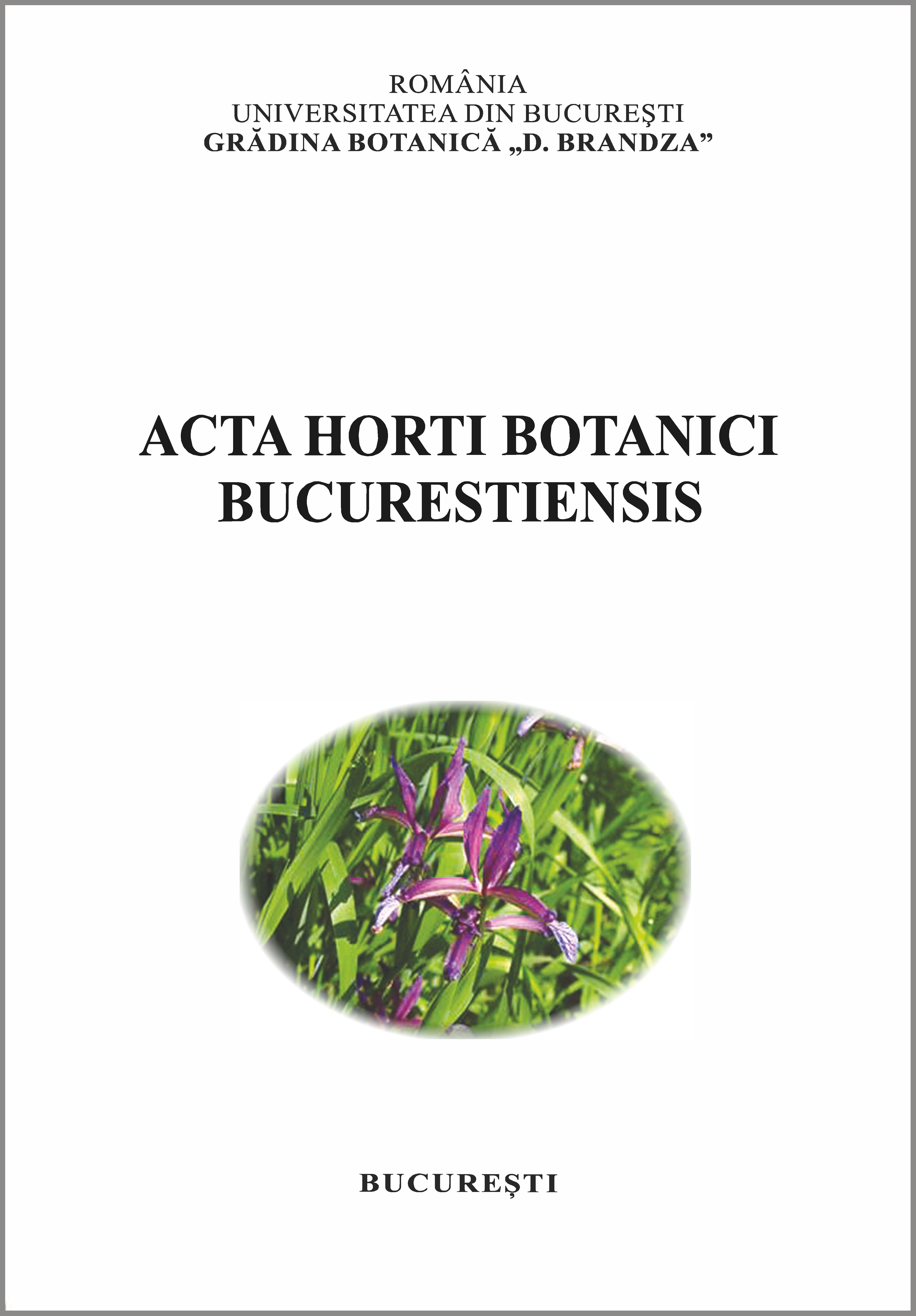
Acta Horti Botanici Bucurestiensis
Acta Horti Botanici Bucurestiensis is a scientific international journal founded in 1959, published once a year. The journal publishes original papers focused on aspects of plant anatomy and morphology, systematic botany, plant, algae and fungi biodiversity, plant physiology and biochemistry, plant genetics and biotechnology, plant pathology, horticulture.
-

Annals of the University of Bucharest. Geography Series
Analele Universitatii Bucuresti: Geografie (Annals of the University of Bucharest – Geography Series) is a yearly peer-reviewed scientific journal dating since 1952. It has an integrative approach publishing articles from various fields of interest both of physical geography (geomorphology, climatology, hydrology, etc.) and of human geography (geodemography, settlement geography, social geography, etc.). Its aims are to comprise themes of large interest from various domains of activity for geographers in general as geography itself is a broad discipline with a high interdisciplinary character. The journal contents research articles, discussions of current issues of large interest for different geographic disciplines, case studies, reports, book reviews. Articles are relevant to both academics and practitioners, and are the results of anonymous reviews by at least two referees chosen by the editor for their specialist knowledge.
-
Analele Universității București. Informatică
The journal is primarily devoted to papers in Computer Science. It will also publish a list of open problems, reviews of books, monographs, proceedings and miscellanea. Of great interest are the following domains: Artificial Intelligence, Automata Theory, Computational Complexity, Computer Simulation and Monte Carlo Methods, Formal Languages, Program Schemes, Theory of Programming Languages, Recursive Functions. Other topics, such as Boolean Algebra, Combinatorics, Constructive Mathematics, Graph Theory, Computational Statistics and Numerical Analysis are also included, to the extent to which they are relevant to Computer Science.
-

Analele Universității din București - Istorie
Analele Universităţii din Bucureşti - Istorie or The Historical Journal of the University of Bucharest is a fully refereed periodical published by Editura Universităţii din Bucureşti and one of eldest of its kind in Romania. It is published in one issue every year since 1956 and in two issues per year starting 2011.
The Historical Journal of the University of Bucharest was devoted, from the moment if its inception, to promoting original research. It published a number of the most reputed Romanian historians of the last decades, but it also welcomed many contributions from international scholars. Open to topics covering all periods of history since Antiquity to the present times and all field of historical research, Analele Universităţii din Bucureşti - Istorie also hosted opinions on the theoretical and methodological approaches to researching, interpreting and writing history.
The journal publishes articles of original and significant research and interpretation, reviews of scholarly books and topical review essays. In the last years, the journal encouraged quality submissions from graduate students and young reseachers.
-

Annals of the University of Bucharest. Philosophy Series
The Annals of the University of Bucharest – Philosophy Series, is a philosophical research open-access journal, published by the University of Bucharest, Faculty of Philosophy.
The Annals of the University of Bucharest, Philosophy Series, is a scholarly double blind peer reviewed journal. The journal publishes articles considered of relevance for those interested in the field of philosophy and is addressed both to the Romanian and international philosophical community, with a special accent on East- and Central-European area.
The Annals of the University of Bucharest, Philosophical series, is devoted to the exploration of different topics of Philosophy.
Currently the journal is indexed by EBSCOhost, Philosopher’s Index with Full Text , ERIH PLUS, CEEOL, DOAJ, ESCI. -
Analele Universității București. Limba și literatură română
The journal Analele Universităţii Bucureşti. Limba şi literatura română [Annals of the University of Bucharest. Romanian Language and Literature] publishes articles and reviews dealing with various and relevant philological topics in neighboring disciplines: linguistics regarding Romanian and/or other languages; Romanian literature; universal and comparative literature; theory of literature; Romanian and comparative folklore; cultural anthropology; it also encourages researches undertaken from a pluri- and interdisciplinary perspective, which place the Romanian language, literature, and culture in a broader theoretical and analytical framework.
The journal is available both in print and electronic format (open access, on the webpage http://anale.litere.ro/index.html).
The journal is indexed in various international data bases (Erih Plus, Ebsco, CEEOL, etc.) and is recognised by The National Council for Research in Higher Education (CNCS, B category).
-
Analele Universităţii Bucureşti. Limbi şi Literaturi Străine
Analele Universității din București. Limbi și Literaturi Străine (“The Annals of the University of Bucharest”, Foreign Languages and Literatures) is a biannual scientific journal which covers a broad range of topics in linguistics, literature, cultural studies and translation studies.
Commenced publication: 1952
ISSN: 1220-0263
ISSN 3008-6035 (online)
ISSN-L 1220-0263The Annals of the University of Bucharest, Foreign Languages and Literatures is an open access journal distributed in accordance with the CC-BY-NC-ND (Creative Commons Attribution – NonCommercial – NoDerivatives 4.0 International) license: the work can be used by mentioning the author and the license, but only for non-commercial purposes and only in the original version. For further information HERE.
-

Annals of the University of Bucharest. Political Science Series
Analele Universităţii din Bucureşti. Ştiinţe Politice [Annals of the University of Bucharest. Political Science Series] is the open access peer-review academic journal of the Faculty of Political Science, University of Bucharest (FSPUB) and it is published by Bucharest University Press. As of the 2020/2021 academic year, it is administratively managed within the Department of Comparative Governance and European Studies of FSPUB. Established in 1999 as yearly publication, since 2011 it has two issues per year and covers all major fields within political science(s), promoting an interdisciplinary perspective on the discipline.
-
Bucharest Working Papers in Linguistics
Bucharest Working Papers in Linguistics publishes novel contributions of current interest in all areas of theoretical and applied linguistics. It aims to offer a platform for synchronic and diachronic research, with no specific theoretical or trend bias. The only criteria applied in the selection of papers are research quality and scholarly integrity.
The journal publishes articles, review articles and book reviews of recently published titles. Themed special issues are also welcomed.
From 2020, all papers are assigned a Digital Object Identifier (DOI) at the time of publication.
Bucharest Working Papers in Linguistics is a fully open access journal. It is published in print and online twice a year by the Centre for the Study of Language Development and Linguistic Communication, University of Bucharest. It has been continuously published since 1999.
Bucharest Working Papers in Linguistics is a double-blind peer-reviewed journal. The reviewers are experts in the domain of the paper which they are invited to evaluate.
The journal has no submission charges and no article processing charges for authors. Financial support (DOI registration, web hosting, printing, and distribution) is provided by The University of Bucharest.
-
Bukarester Beiträge zur Germanistik
BBG aims at offering a platform for the discussion of linguistic, literary, translatological, and didactic subject matters in German studies. The annual thematic issues may also include other articles on different topics under Varia.
-
Euro-Atlantic Studies New Series
Euro-Atlantic Studies (EAS) is an academic, peer-reviewed, and open-access journal, published by the Centre of Euro-Atlantic Studies „Prof.univ.dr. Constantin Bușe” of the University of Bucharest. Founded in 1998, the journal aims to make available to the scientific community and the general public the results of recent academic research in the field of International Relations.
The Journal also aims to provide help to authors to publish their papers conveniently and spread their research worldwide, stimulating academic debate in the field of social sciences. We try our best to ensure the novelty of each research manuscript being published in EAS.
-

GeoPatterns
GeoPatterns was founded in 2016 and it is supported and promoted by the the Center for Risk Studies, Spatial Modelling, Terrestrial and Coastal System Dynamics, Department of Geomorphology, Faculty of Geography, University of Bucharest. GeoPatterns publishes mainly original, high quality, peer-reviewed (DOI-assigned) research papers in all fields of spatially integrated geosciences and humanities, as well as reviews, research notes, and reports. The aim of GeoPatterns is to build a framework for the holistic understanding of our planet and its natural and social environments, by identifying the patterns that sustain the world.
All scientific papers accepted for publication are thoroughly analysed by a scientific committee formed by Romanian and foreign university professors, internationally recognized in their area of expertise.
GeoPatterns’s topics coverage makes the journal essential reading for geographers, as well as for researchers from other disciplines, such as disaster management, ecology, geology, sociology, psychology, anthropology (links nature and culture), environmental studies, urban planning, and cultural studies. The main language of the journal is English.
GeoPatterns is an open access journal and the content of the journal is freely available immediately upon publication.
-
Human Geographies – Journal of Studies and Research in Human Geography
Human Geographies – Journal of Studies and Research in Human Geography was first published in 2007 to provide an international forum of social, economic and cultural contributions to the fields of human geography. It is a peer-reviewed journal, has both online and print versions and ISSNs. It represents the initiative and effort of the members of the Human Geography Department, Faculty of Geography from University of Bucharest.
Human Geographies – is a biannual publication with a content solely in English which can be viewed at humangeographies.org.ro.
Human Geographies is committed to publish scholarly research and informed commentaries on a wide category of human geography aspects (including urban and rural issues, demography, social, economic and cultural environment), place issues, and space issues. It welcomes contributions from the growing numbers of scholars and practitioners across geography, humanities and social and environmental sciences who are interested in human, economic and cultural geographies. The publication is particularly committed to the development of interpretative approaches to the above mentioned issues. It does not restrict its remit to any particular methodological or theoretical orientation, but publishes both scholarly papers and more speculative pieces designed to further understanding and debate.
Contents include original articles, notes and comments. Regular contributions are drawn from the fields of human geography, economics and economic geography, planning, territorial development, infrastructure development, sociology, population studies and public administration, public policies.
-

[Inter]sections
[Inter]sections is the annual double-blind peer reviewed journal of American Studies at the University of Bucharest.
The language of the journal is English (US). Its first peer reviewed issue came out in 2009. From 2009 to 2012, it was a quarterly peer-reviewed publication.
Please note that [Inter]sections does not charge its authors (there are no article processing charges or submission charges).
-
Journal of Comparative Research in Anthropology and Sociology
The Journal of Comparative Research in Anthropology and Sociology – Compaso (ISSN 2068 – 0317) is an online, open-access, peer-reviewed academic journal published by the Department of Sociology and the Doctoral School of Sociology at the University of Bucharest. The journal provides a platform for scientific dialogue by advancing a comparative outlook that bridges empirical research and theoretical inquiry within and across the fields of anthropology and sociology.
-
MELISENDRA. Journal of Spanish Early Modernity Studies
MELISENDRA. Journal of Spanish Early Modernity Studies publishes annually original investigation studies written in Spanish and English, on topics related to Spanish Early Modernity on both sides of the Atlantic. Preference is given to interdisciplinary studies elaborated from a historical-comparative perspective. The contents of the journal can be accessed free of charge on the website of the Publishing House of the University of Bucharest and on Melisendra website.
The works published in this journal include the title, the abstract and approximately 5 keywords, written both in English and Spanish. Each work includes its author´s full name and E-mail address. Previously to their publication, the articles have been anonymously subjected to a process of double-blind peer review, performed by objective and independent evaluators, whose affiliations to universities and investigation institutions are completely different from those of the authors´.
Facts and opinions displayed in the works published here are the exclusive responsibility of their authors. The Editorial Committee of MELISENDRA. Journal of Spanish Early Modernity Studies is by no means to be held responsible for the published works authenticity or credibility. Their visions, perspectives, and opinions do not necessarily reflect the ones of the editorial team. The contents of the original works published in this journal are the exclusive property of the journal and of the Publishing House of the University of Bucharest. Therefore, any full or partial citation or reproduction must include their source.
-
Revista Cercurilor studenţeşti ale Departamentului de Limba şi Literatura Franceză
Hosted by the Bucharest University Press, Revista Cercurilor studenţeşti ale Departamentului de Limba şi Literatura Franceză (RCSDLLF) – ‘The French Department’s Student Research Group Journal’ – is a yearly publication of the French Language and Literature Department (Faculty of Foreign Languages and Literatures, University of Bucharest), founded in 2012 and opened to contributors among the students of all 3 education degrees the Department provides (bachelor’s degree – licence, master’s degree and doctorate). The journal gathers the best papers authored by members of the Department’s five student scientific research groups: French Literature, Culture and Civilization; French theoretical and applied linguistics; ContrasTER (Contrastive analysis, specialized translations and terminology), CENTRAL (literary translations), and The extreme contemporary literature: the Prix Goncourt. Selections by Romanian Students (a research group organized around the works of the Bucharest Jury that designates the Romanian laureate of the Prix Goncourt, an international cultural event the French Language and Literature Department is part of since 2013). Other contributions presented by our students in all kinds of national or international scientific events are also included. Each contribution is validated by an expert who officially endorses its coordination as well as by a prestigious international scientific committee.
All contributions are written in French.
-
Revista CICSA online, serie nouă/ CICSA Journal online, New Series
Revista CICSA, serie nouă reprezintă publicația anuală online a Centrului de Istorie Comparată a Societăților Antice (CICSA), în conținutul căreia se regăsesc studii și articole (redactate în limbi de circulație internațională), recenzii și prezentări de carte, din domeniile: istorie, istorie antică, arheologie, artă, istorie culturală, studii culturale. Materialele publicate reprezintă prioritar activitatea de cercetare a Centrului, redactările comunicărilor susținute în cadrul sesiunilor sale lunare și anuale, dar și alte contribuții și analize pluridisciplinare ale unor subiecte din domeniile menționate, după ce au fost supuse unui sistem de peer reviewed, specificat și în normele de redactare.
-
Romanian Journal of Journalism and Communication
Field: A peer-reviewed academic journal dedicated to research in journalism, communication studies, and media theory, with a critical, interdisciplinary approach.
Publisher / Institution: Published by the Faculty of Journalism and Communication Studies, University of Bucharest.
Languages: The primary language of publication is English, with an option to accept submissions in French.
Aim and Scope: The journal aims to connect Romanian and Central and Eastern European scholarship to the global field of communication studies, while also bringing relevant international research into dialogue with the region. It promotes original, critical contributions that explore transformations in media, journalism, technology, and the public sphere from comparative, interdisciplinary, and global perspectives.
Types of contributions: Publishes theoretical, empirical, and critical articles, case studies, as well as book reviews. Innovative and emerging approaches in communication research are encouraged. -
Reviews in Biological and Biomedical Science
Reviews in Biological and Biomedical Sciences (Rev. Biol. Biomed. Sci.) is a new online only, open access, multidisciplinary journal, launched by Bucharest University in 2018.
Welcoming outstanding review articles of any length from around the world, Rev. Biol. Biomed. Sci. will cover all disciplines in biological and biomedical sciences such as biochemistry, biodiversity, bioinformatics, biomedical engineering, biophysics, biotechnology, cell biology, clinical chemistry, cytopathology, developmental biology, ecology, epidemiology, ethology, genetics, hematology, histopathology, immunology, microbiology, molecular biology, morphology, mycology, oncology, parasitology, pharmacology, physiology, reproductive technology, stem cells, systematics, tissue banking/transplant, toxicology.
The journal encourages submissions from current or recently completed PhD students, and young researches, but we welcome the submissions from established experts regardless of their age.
Manuscripts that pass the initial assessment are peer-reviewed to a high standard and final decisions are based on the reports received from the referees.
The Journal of biological and biomedical sciences reviews is free to access online and there are no manuscript submission charges nor article processing charges and no publication fees. All Rev. Biol. Biomed. Sci. papers are free to read, share and reuse for non-commercial purposes under the CC-BY-NC 4.0 licence.
Journal of biological and biomedical sciences reviews allow the author(s) to hold the copyright and to retain publishing rights without restrictions.
Website: https://rev-biomed.unibuc.ro/
-
Romano-arabica
Romano-Arabica is an annual, peer-reviewed, international journal published by the Center for Arab Studies, University of Bucharest, since 2001. In 2018, it was evaluated in the A-class Academic Journal Articles category by Agenzia Nazionale di Valutazione del Sistema Universitario e della Ricerca (ANVUR) in Italy, and in 2020, CNCS (Consiliul Național al Cercetării Științifice – National Council for Scientific Research) classified it as a category A journal in the field of humanities. The journal is dedicated to the study of Arabic language (classical and dialectal), Arab literature (classical and modern), Islamic thought, Islamic societies, the interaction between the Arab civilization and other civilizations, etc. The Editorial and Advisory Board consists of the academic staff of the Center for Arab Studies of the University of Bucharest and leading scholars in Arab and Islamic studies from prestigious academic institutions around the world.
Indexed by SCOPUS - https://www.scopus.com/sourceid/21100394703
-
Romanian Biotechnological Letters
The Romanian Biotechnological Letters journal (hereinafter RBL), published by the University of Bucharest was founded by Prof. IOAN I.F. DUMITRU and has now become one of the most important international scientific journals in the field of biotechnology and related disciplines published in Romania.
The Journal publishes original research articles, reviews and short communications. The main thematic areas of publications supported by RBL are: cellular and molecular biology, applied microbiology (microbial ecology, industrial microbiology, medical microbiology, immunology), functional genomics, metabolic engineering, physiology, ecology, nanotechnology, agriculture and farming improvement techniques, development of experimental methodology in medical, materials, life sciences and biotechnology.
The RBL editorial committee is formed by academic and research scientific personalities from Romania, Ireland, England, Germany, Turkey, Serbia, India, USA and Canada.
The RBL journal is included in the UEFISCDI (Executive Unit for Financing Higher Education, Research, Development and Innovation) list of the ISI - indexed Romanian journals on the basis of indexation in the Science Citation Index Expanded (SCI-EXPANDED), being also indexed in other major databases or regular periodicals of scientific information with an old tradition in the international scientific community. -
Romanian Journal of Analytic Philosophy
The journal publishes articles in analytic philosophy broadly construed. Topics range from logic, philosophy of mathematics and epistemology to metaphysics, philosophy of biology, philosophy of cognitive science and philosophy of language, but is not limited to these areas. Submissions are subject to peer blind review. For issues in the past two years, more than 28% of submissions were published after at most two rounds of review. The journal primarily targets early career researchers in philosophy or doctoral students, but carefully analyzes each submission and is open to all collaborative projects, especially those coming from researchers in social sciences or humanities.
-
Romanian Studies Today
As a transdisciplinary journal, Romanian Studies Today has the purpose to maintain a constant scientific interest in the topics related to regional philology and regional studies. The journal publishes one issue per year both print, and online. Its main domains include: the positioning of Romanian studies as integrating part of contemporary social and humanities subjects, issues related to Romanian as a foreign/non-native language. Romanian Studies Today is a journal for specialists, researchers and instructors in Romanian studies in all universities and research centres, and also for specialists, researchers and instructors in regional studies, history, anthropology, political studies or researchers in other domains with an interest in Romanian language, literature, culture and civilisation.
Romanian Studies Today is edited by the Centre of Romanian Studies at the Faculty of Letters, University of Bucharest. The journal was established following the incorporation of the Centre of Romanian Studies at the University of Bucharest. One of objectives of the Centre was to edit a pluri- and interdisciplinary journal, observing all scientific regulations in force, meant for national and international academia, with focus on Romanian Studies. The first issue was published in 2017. Albeit rather recent, our journal has enjoyed the publication of some prestigious authors in the field of Romanian Studies from Romania and from abroad.
-
Slovo
Slovo is an multidisciplinary, undergraduate and postgraduate Faculty-reviewed academic journal, affiliated with the Russian and Slavic Philology Department, Faculty of Foreign Languages and Literatures, University of Bucharest and other higher education institutions. The journal is focused on presenting student scholarship in the fields of Slavic and East-European cultural, social and political affairs. Slovo encourages student research by offering valuable early experience of academic publishing. Slovo publishes articles of original research and interpretation, reviews of scholarly books, literary translations.
-
Studia Doctoralia Psychology and Educational Science
Studia Doctoralia Psychology and Educational Science is the official journal of The Doctoral School of Psychology and Educational Sciences, University of Bucharest, Romania, published by the Doctoral Centre for Interdisciplinary Research, Innovation and Sustainable Development (CCIIDD).
Studia Doctoralia is indexed by Google Scholar, ROAD (Directory of Open Access Scholarly Resources) and SCIPIO (Scientific Publishing & Information Online; CNCSIS - UEFISCDI institution).
Studia Doctoralia is also registered in ICI World of Journals database (Index Coperncius International).
All articles will receive a DOI indexed by CrossRef.
-
Studia Politica. Romanian Political Science Review
Studia Politica. Romanian Political Science Review publishes high quality, peer-reviewed, open-access articles in all major areas of political science, including Romanian politics, European politics, political theory, comparative politics, political sociology, public policy, international relations, and global studies.
-
Styles of Communication
Styles of Communication is an international open access journal which is published bi-annually by the Faculty of Journalism and Communication Studies (University of Bucharest, Romania) in cooperation with the Committee for Philology of the Polish Academy of Sciences, Wrocław Branch, Poland.
The main purpose of Styles of Communication is to show the unity existing within global diversity. As communication implies, besides the transfer of information to others and the decoding of the others’ messages, the production of meaning within (non)verbal texts/objects is closely connected to interculturality, creativity and innovation and it needs a refining of styles in order to avoid misunderstandings.
This journal is a plea for interdisciplinarity as its aim is to include different perspectives on cultural studies, coming from different fields, such as communication, political and sociological studies, public relations, semiotics, linguistics, anthropology, translation studies and so on.
-
Theoretical and Applied Linguistics@ro
Theoretical and Applied Linguistics@ro is an open access journal edited by the Department of Linguistics at the University of Bucharest, Faculty of Letters.
-
University Arena
Annual journal of articles in the interdisciplinary fields: science of sport and physical education and health
-
University of Bucharest Review. Literary and Cultural Studies Series
University of Bucharest Review was founded in 1999 and has been a constant presence on the Romanian academic scene ever since. Over the years, we have published issues bearing such diverse titles as Fictions of Nature, Genres and Historicity, Durability and Transience, Writing the Self, or Modernity: The Crisis of Value and Judgment which include papers focusing on various topics from the fields of critical theory, literary criticism, social anthropology, British, American and Canadian cultural studies, translatology, comparative literature, the study of nationalism and postcommunism.
We have always encouraged all contributors to approach these topics in an unbiased and open manner, so that their papers would reflect the current controversies on the role of literature in the humanities and in society at large, the contentious relationship between cultural theory and cultural practice, the unstable balance between centre and margin, the elusive nature of truth, the fluctuations of cultural identities, norms and values in today’s world, regarded both as a global village and as a cluster of competing local cultures.
The journal’s originality lies primarily in the following cherished values: 1. inclusiveness: open to both literature-centered, and culture-centered scholarship, both theory, and practice/ applied analysis, and coverage of the entire English-speaking space; 2. pluralism: no theoretical or ideological partisanship, pooling scholars from all areas of the world, all national and academic cultures; open-minded engaging of contentious subjects; 3. extended cultural discourse studies: screening the entire field of applicability for the notion of discourse and discourse studies as a suprasegmental concept, meant to bring together under the same umbrella critical theories, literary criticism, social anthropology, British, American and Canadian cultural studies, translation theories, comparative literature, as well as the study of nationalism and post-communism, visual culture and performance arts.
UBR publishes two issues at the end of each calendar year.
-

Verbum. Revista de teologie catolică
Verbum. Revistă de Teologie Catolică continues the legacy established in Bucharest by Revista Catolică, a journal published between 1912 and 1916, which featured research and reflections by distinguished Catholic theologians and intellectuals, including Archbishop Raymund Netzhammer, Blessed Vladimir Ghika, Carol Auner, Mariu Theodorian-Carada, C. I. Filitti, and Blessed Anton Durcovici. This tradition was revived in 1990 at the initiative of Archbishop Ioan Robu through Revista Catolică Verbum, which was published regularly until 1996 and included contributions from prominent scholars such as Ion Gheție, Petre Ș. Năsturel, and Violeta Barbu. Between 2011 and 2018, Caietele Institutului Catolic carried forward this tradition, strengthening the presence of Catholic theology and theologians within Romanian academia.
